
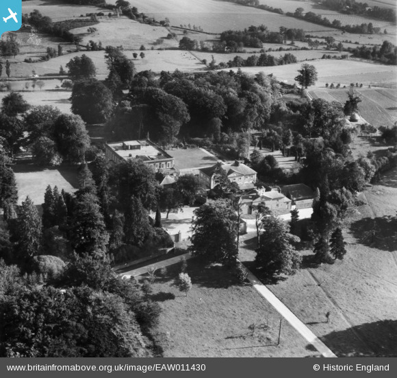
EAW011430 ENGLAND (1947). Buxted Park, Buxted, 1947
© Copyright OpenStreetMap contributors and licensed by the OpenStreetMap Foundation. 2026. Cartography is licensed as CC BY-SA.
Nearby Images (11)
EAW011430

EAW011431

EAW011432

EAW011433

EAW011427

EAW011425

EAW011426

EAW011428

EAW011429

EAW011424

EAW011423

Details
| Title | [EAW011430] Buxted Park, Buxted, 1947 |
| Reference | EAW011430 |
| Date | 1-October-1947 |
| Link | |
| Place name | BUXTED |
| Parish | BUXTED |
| District | |
| Country | ENGLAND |
| Easting / Northing | 548500, 122807 |
| Longitude / Latitude | 0.11591877996019, 50.984945352932 |
| National Grid Reference | TQ485228 |
Pins
Be the first to add a comment to this image!