
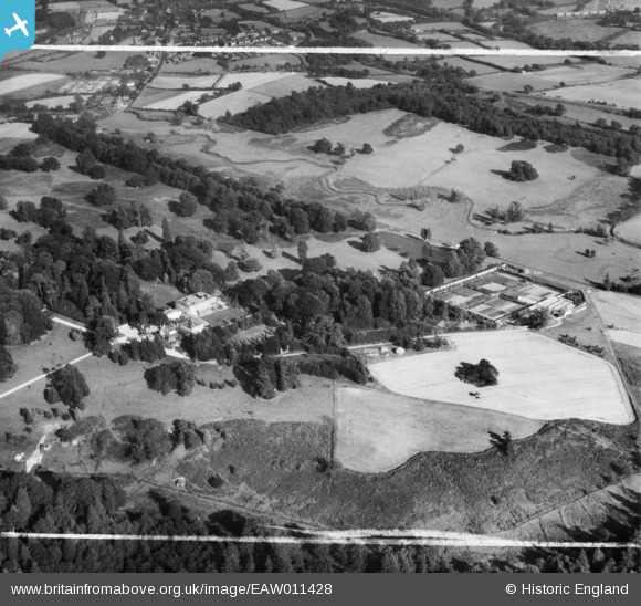
EAW011428 ENGLAND (1947). Buxted Park, Buxted, 1947. This image was marked by Aerofilms Ltd for photo editing.
© Copyright OpenStreetMap contributors and licensed by the OpenStreetMap Foundation. 2026. Cartography is licensed as CC BY-SA.
Nearby Images (11)
EAW011428

EAW011424

EAW011423

EAW011429

EAW011433

EAW011425

EAW011430

EAW011432

EAW011431

EAW011427

EAW011426

Details
| Title | [EAW011428] Buxted Park, Buxted, 1947. This image was marked by Aerofilms Ltd for photo editing. |
| Reference | EAW011428 |
| Date | 1-October-1947 |
| Link | |
| Place name | BUXTED |
| Parish | BUXTED |
| District | |
| Country | ENGLAND |
| Easting / Northing | 548582, 122690 |
| Longitude / Latitude | 0.11703846636076, 50.983872694471 |
| National Grid Reference | TQ486227 |
Pins

Matt Aldred edob.mattaldred.com |
Thursday 11th of March 2021 03:33:49 PM | |
|
Matt Aldred edob.mattaldred.com |
Thursday 11th of March 2021 03:33:19 PM | |
|
Matt Aldred edob.mattaldred.com |
Sunday 29th of November 2020 04:23:39 PM | |

Richard Dawson |
Thursday 28th of September 2017 02:49:48 PM | |
|
Robnotso |
Friday 19th of August 2016 05:33:51 PM | |
|
cptpies |
Thursday 11th of December 2014 02:21:40 PM |
User Comment Contributions
PIllbox, Buxted Park. |
cptpies |
Thursday 11th of December 2014 02:23:05 PM |