
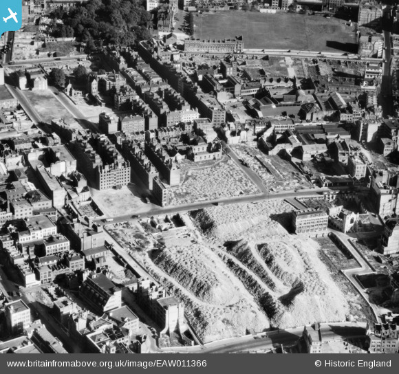
EAW011366 ENGLAND (1947). Cleared ground and piles of rubble at Whitecross Street, St Luke's, 1947
© Copyright OpenStreetMap contributors and licensed by the OpenStreetMap Foundation. 2026. Cartography is licensed as CC BY-SA.
Nearby Images (17)
EAW011366

EAW011216

EAW041392

EAW041393

EAW041390

EAW041387

EAW041391

EAW041384

EAW041388

EAW041386

EAW041389

EAW041385

EAW011201

EAW011117

EAW011215

EAW011076

EAW011200

Details
| Title | [EAW011366] Cleared ground and piles of rubble at Whitecross Street, St Luke's, 1947 |
| Reference | EAW011366 |
| Date | 3-October-1947 |
| Link | |
| Place name | ST LUKE'S |
| Parish | |
| District | |
| Country | ENGLAND |
| Easting / Northing | 532438, 182186 |
| Longitude / Latitude | -0.09081637710594, 51.522560556094 |
| National Grid Reference | TQ324822 |
