
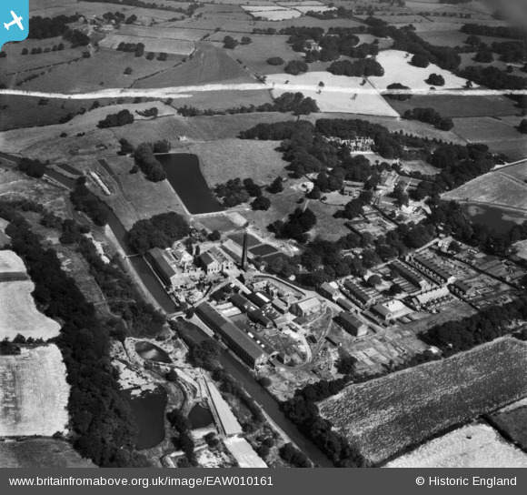
EAW010161 ENGLAND (1947). The Wiggins Teape and Co Withnell Fold Paper Mills and environs, Withnell Fold, 1947. This image was marked by Aerofilms Ltd for photo editing.
© Copyright OpenStreetMap contributors and licensed by the OpenStreetMap Foundation. 2026. Cartography is licensed as CC BY-SA.
Nearby Images (14)
EAW010161

EAW010390

EAW010159

EAW010388

EAW010160

EAW012428

EAW012429

EAW012427

EAW010389

EAW012424

EAW012425

EAW012422

EAW012426

EAW012423

Details
| Title | [EAW010161] The Wiggins Teape and Co Withnell Fold Paper Mills and environs, Withnell Fold, 1947. This image was marked by Aerofilms Ltd for photo editing. |
| Reference | EAW010161 |
| Date | 29-August-1947 |
| Link | |
| Place name | WITHNELL FOLD |
| Parish | WITHNELL |
| District | |
| Country | ENGLAND |
| Easting / Northing | 361232, 423191 |
| Longitude / Latitude | -2.587324793693, 53.703483465507 |
| National Grid Reference | SD612232 |

