
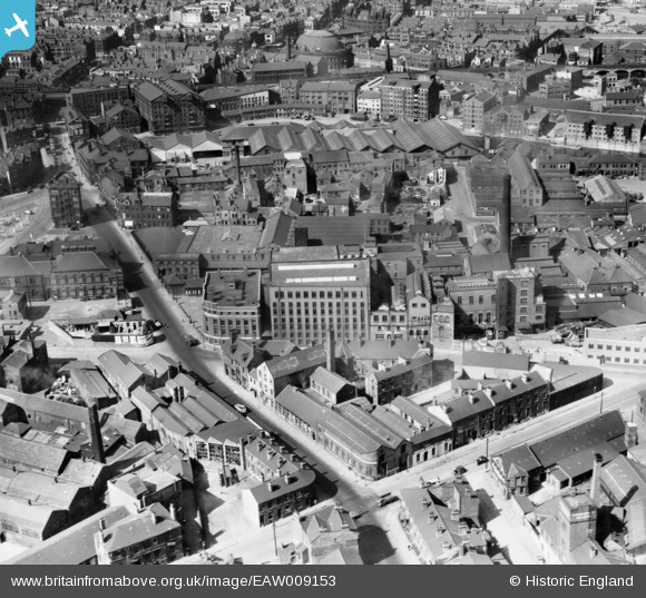
EAW009153 ENGLAND (1947). J. Tetley and Son Ltd Brewery and environs, Leeds, 1947
© Copyright OpenStreetMap contributors and licensed by the OpenStreetMap Foundation. 2026. Cartography is licensed as CC BY-SA.
Nearby Images (35)
EAW009153

EAW009154

EPW043138

EPW043139

EPW043142

EPW043140

EPW043143

EAW047058

EAW047062

EAW047056

EAW047059

EAW009158

EAW047064

EAW047063

EAW047060

EAW047061

EAW009148

EAW050292

EAW044378

EAW009156

EAW047057

EAW009150

EAW050286

EAW050291

EAW009149

EAW009152

EAW050287

EPW043141

EAW009155

EAW009151

EAW009157

EAW050293

EAW050289

EAW050290

EAW050288

Details
| Title | [EAW009153] J. Tetley and Son Ltd Brewery and environs, Leeds, 1947 |
| Reference | EAW009153 |
| Date | 15-August-1947 |
| Link | |
| Place name | LEEDS |
| Parish | |
| District | |
| Country | ENGLAND |
| Easting / Northing | 430454, 432947 |
| Longitude / Latitude | -1.5376631921063, 53.791729397971 |
| National Grid Reference | SE305329 |
Pins

Sparky |
Monday 14th of August 2017 11:31:52 PM |