
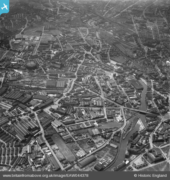
EAW044378 ENGLAND (1952). The Pottery Field and Camp Field areas, Leeds, 1952
© Copyright OpenStreetMap contributors and licensed by the OpenStreetMap Foundation. 2026. Cartography is licensed as CC BY-SA.
Nearby Images (28)
EAW044378

EPW043140

EPW043143

EAW009153

EAW009154

EAW047059

EAW047062

EAW047058

EPW043138

EPW043139

EPW043142

EAW047056

EAW009158

EAW047064

EAW047057

EAW009148

EAW047063

EAW047060

EAW009156

EAW047061

EAW050292

EAW009149

EPW043141

EAW050286

EAW009150

EAW050291

EAW009152

EPW031644

Details
| Title | [EAW044378] The Pottery Field and Camp Field areas, Leeds, 1952 |
| Reference | EAW044378 |
| Date | 27-June-1952 |
| Link | |
| Place name | LEEDS |
| Parish | |
| District | |
| Country | ENGLAND |
| Easting / Northing | 430448, 432840 |
| Longitude / Latitude | -1.5377648516378, 53.790767954939 |
| National Grid Reference | SE304328 |
Pins
Be the first to add a comment to this image!