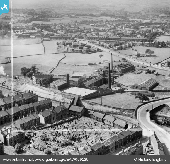
EAW009129 ENGLAND (1947). Beckside Worsted Mills at Great Horton, Bradford, 1947. This image was marked by Aerofilms Ltd for photo editing.
© Copyright OpenStreetMap contributors and licensed by the OpenStreetMap Foundation. 2026. Cartography is licensed as CC BY-SA.
Nearby Images (12)
Details
| Title | [EAW009129] Beckside Worsted Mills at Great Horton, Bradford, 1947. This image was marked by Aerofilms Ltd for photo editing. |
| Reference | EAW009129 |
| Date | 15-August-1947 |
| Link | |
| Place name | BRADFORD |
| Parish | |
| District | |
| Country | ENGLAND |
| Easting / Northing | 414022, 431905 |
| Longitude / Latitude | -1.7871696842147, 53.783065156002 |
| National Grid Reference | SE140319 |


![[EAW009129] Beckside Worsted Mills at Great Horton, Bradford, 1947. This image was marked by Aerofilms Ltd for photo editing.](http://britainfromabove.org.uk/sites/all/libraries/aerofilms-images/public/100x100/EAW/009/EAW009129.jpg)
![[EAW009133] Beckside Worsted Mills at Great Horton, Bradford, 1947. This image was marked by Aerofilms Ltd for photo editing.](http://britainfromabove.org.uk/sites/all/libraries/aerofilms-images/public/100x100/EAW/009/EAW009133.jpg)
![[EAW009128] Beckside Worsted Mills at Great Horton, Bradford, 1947](http://britainfromabove.org.uk/sites/all/libraries/aerofilms-images/public/100x100/EAW/009/EAW009128.jpg)
![[EAW009131] Beckside Worsted Mills at Great Horton, Bradford, 1947](http://britainfromabove.org.uk/sites/all/libraries/aerofilms-images/public/100x100/EAW/009/EAW009131.jpg)
![[EAW009136] Beckside Worsted Mills at Great Horton, Bradford, 1947. This image was marked by Aerofilms Ltd for photo editing.](http://britainfromabove.org.uk/sites/all/libraries/aerofilms-images/public/100x100/EAW/009/EAW009136.jpg)
![[EAW009130] Beckside Worsted Mills at Great Horton, Bradford, 1947](http://britainfromabove.org.uk/sites/all/libraries/aerofilms-images/public/100x100/EAW/009/EAW009130.jpg)
![[EAW009137] Beckside Worsted Mills at Great Horton, Bradford, 1947](http://britainfromabove.org.uk/sites/all/libraries/aerofilms-images/public/100x100/EAW/009/EAW009137.jpg)
![[EAW009132] Beckside Worsted Mills at Great Horton, Bradford, 1947](http://britainfromabove.org.uk/sites/all/libraries/aerofilms-images/public/100x100/EAW/009/EAW009132.jpg)
![[EAW009134] Beckside Worsted Mills at Great Horton, Bradford, 1947](http://britainfromabove.org.uk/sites/all/libraries/aerofilms-images/public/100x100/EAW/009/EAW009134.jpg)
![[EAW009135] Beckside Worsted Mills at Great Horton, Bradford, 1947. This image was marked by Aerofilms Ltd for photo editing.](http://britainfromabove.org.uk/sites/all/libraries/aerofilms-images/public/100x100/EAW/009/EAW009135.jpg)
![[EPW024410] Westcroft Mill and St John the Evangelist's Church, Great Horton, 1928](http://britainfromabove.org.uk/sites/all/libraries/aerofilms-images/public/100x100/EPW/024/EPW024410.jpg)
![[EPW052161] Great Horton and Little Horton, Bradford, 1936. This image has been produced from a print.](http://britainfromabove.org.uk/sites/all/libraries/aerofilms-images/public/100x100/EPW/052/EPW052161.jpg)
