
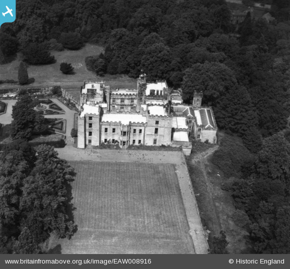
EAW008916 ENGLAND (1947). Chillingham Castle, Chillingham, 1947. This image has been produced from a print.
© Copyright OpenStreetMap contributors and licensed by the OpenStreetMap Foundation. 2025. Cartography is licensed as CC BY-SA.
Nearby Images (18)
EAW008916

EAW007847

EAW008917

EAW007842

EAW007843

EAW008919

EAW008915

EAW008918

EAW007844

EAW007845

EAW006085

EAW008914

EAW006084

EAW006082

EAW007841

EAW006083

EAW006087

EAW006086

Details
| Title | [EAW008916] Chillingham Castle, Chillingham, 1947. This image has been produced from a print. |
| Reference | EAW008916 |
| Date | 9-August-1947 |
| Link | |
| Place name | CHILLINGHAM |
| Parish | CHILLINGHAM |
| District | |
| Country | ENGLAND |
| Easting / Northing | 406159, 625784 |
| Longitude / Latitude | -1.9024289966041, 55.525748128278 |
| National Grid Reference | NU062258 |
Pins
Be the first to add a comment to this image!