
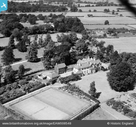
EAW008548 ENGLAND (1947). Raby Vale, Thornton Hough, 1947
© Copyright OpenStreetMap contributors and licensed by the OpenStreetMap Foundation. 2026. Cartography is licensed as CC BY-SA.
Nearby Images (7)
EAW008548

EAW008550

EAW008551

EAW008547

EAW008546

EAW008545
 and surrounding countryside, Thornton Hough, from the east, 1947")
EAW008549

Details
| Title | [EAW008548] Raby Vale, Thornton Hough, 1947 |
| Reference | EAW008548 |
| Date | 27-July-1947 |
| Link | |
| Place name | THORNTON HOUGH |
| Parish | |
| District | |
| Country | ENGLAND |
| Easting / Northing | 331756, 380799 |
| Longitude / Latitude | -3.0245836771987, 53.319443367733 |
| National Grid Reference | SJ318808 |
Pins
Be the first to add a comment to this image!