
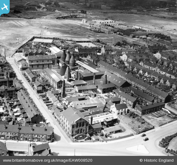
EAW008520 ENGLAND (1947). The Elder Earthenware Works, Cobridge, 1947
© Copyright OpenStreetMap contributors and licensed by the OpenStreetMap Foundation. 2026. Cartography is licensed as CC BY-SA.
Nearby Images (18)
EAW008520

EAW008519

EAW008516

EAW008517

EAW008525

EAW008518

EPW053365
 and St Peter's Roman Catholic Church, Cobridge, 1937")
EAW008525A

EAW008527

EPW053362
 and St Peter's Roman Catholic Church, Cobridge, 1937. This image has been affected by flare.")
EAW008523

EPW053361
 and St Peter's Roman Catholic Church, Cobridge, 1937")
EAW008521

EPW053364
 and St Peter's Roman Catholic Church, Cobridge, 1937")
EPW053360
 and St Peter's Roman Catholic Church, Cobridge, 1937")
EPW053363
, St Peter's Roman Catholic Church and Christ Church, Cobridge, 1937")
EAW008522

EAW008524

Details
| Title | [EAW008520] The Elder Earthenware Works, Cobridge, 1947 |
| Reference | EAW008520 |
| Date | 22-July-1947 |
| Link | |
| Place name | COBRIDGE |
| Parish | |
| District | |
| Country | ENGLAND |
| Easting / Northing | 387526, 348827 |
| Longitude / Latitude | -2.1860468516957, 53.036270724548 |
| National Grid Reference | SJ875488 |
Pins

GB |
Sunday 17th of September 2023 01:44:21 PM | |
|
GB |
Sunday 17th of September 2023 01:43:39 PM | |
|
GB |
Sunday 17th of September 2023 01:41:05 PM | |
|
GB |
Sunday 17th of September 2023 01:40:34 PM | |
|
Wonomma |
Sunday 1st of March 2015 04:57:39 PM | |

bescotbeast |
Wednesday 24th of September 2014 09:09:40 PM |