
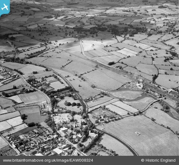
EAW008324 ENGLAND (1947). The River Trent and the Trent and Mersey Canal, Rugeley, from the south, 1947
© Copyright OpenStreetMap contributors and licensed by the OpenStreetMap Foundation. 2026. Cartography is licensed as CC BY-SA.
Nearby Images (3)
EAW008324

EAW008325

EAW008323

Details
| Title | [EAW008324] The River Trent and the Trent and Mersey Canal, Rugeley, from the south, 1947 |
| Reference | EAW008324 |
| Date | 20-July-1947 |
| Link | |
| Place name | RUGELEY |
| Parish | RUGELEY |
| District | |
| Country | ENGLAND |
| Easting / Northing | 404483, 318820 |
| Longitude / Latitude | -1.9335509058053, 52.766623656702 |
| National Grid Reference | SK045188 |
Pins

thomas peake |
Monday 23rd of December 2019 06:39:59 PM |