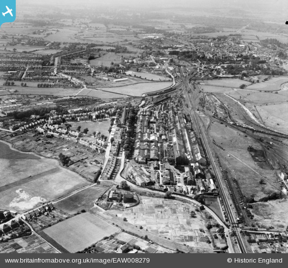
EAW008279 ENGLAND (1947). The Southern Railway Works and New Town, Ashford, 1947
© Copyright OpenStreetMap contributors and licensed by the OpenStreetMap Foundation. 2026. Cartography is licensed as CC BY-SA.
Nearby Images (10)
Details
| Title | [EAW008279] The Southern Railway Works and New Town, Ashford, 1947 |
| Reference | EAW008279 |
| Date | 15-July-1947 |
| Link | |
| Place name | ASHFORD |
| Parish | |
| District | |
| Country | ENGLAND |
| Easting / Northing | 601759, 141579 |
| Longitude / Latitude | 0.88436277965124, 51.137353767505 |
| National Grid Reference | TR018416 |


![[EAW008279] The Southern Railway Works and New Town, Ashford, 1947](http://britainfromabove.org.uk/sites/all/libraries/aerofilms-images/public/100x100/EAW/008/EAW008279.jpg)
![[EAW008271] The Southern Railway Works and New Town, Ashford, 1947](http://britainfromabove.org.uk/sites/all/libraries/aerofilms-images/public/100x100/EAW/008/EAW008271.jpg)
![[EAW008275] The Southern Railway Works, Ashford, 1947](http://britainfromabove.org.uk/sites/all/libraries/aerofilms-images/public/100x100/EAW/008/EAW008275.jpg)
![[EPW007028] The South East and Chatham Co Railway Works, Ashford, 1921](http://britainfromabove.org.uk/sites/all/libraries/aerofilms-images/public/100x100/EPW/007/EPW007028.jpg)
![[EPW026085] The Southern Railway Works and New Town, Ashford, 1929](http://britainfromabove.org.uk/sites/all/libraries/aerofilms-images/public/100x100/EPW/026/EPW026085.jpg)
![[EAW008280] The Southern Railway Works, Ashford, 1947](http://britainfromabove.org.uk/sites/all/libraries/aerofilms-images/public/100x100/EAW/008/EAW008280.jpg)
![[EAW008276] The Southern Railway Works, Ashford, 1947](http://britainfromabove.org.uk/sites/all/libraries/aerofilms-images/public/100x100/EAW/008/EAW008276.jpg)
![[EPW000521] The South East and Chatham Railway Company Works at New Town, Ashford, 1920. This image has been produced from a copy negative.](http://britainfromabove.org.uk/sites/all/libraries/aerofilms-images/public/100x100/EPW/000/EPW000521.jpg)
![[EAW008272] The Southern Railway Works and New Town, Ashford, 1947](http://britainfromabove.org.uk/sites/all/libraries/aerofilms-images/public/100x100/EAW/008/EAW008272.jpg)
![[EAW008278] The Southern Railway Works and New Town, Ashford, 1947](http://britainfromabove.org.uk/sites/all/libraries/aerofilms-images/public/100x100/EAW/008/EAW008278.jpg)

