
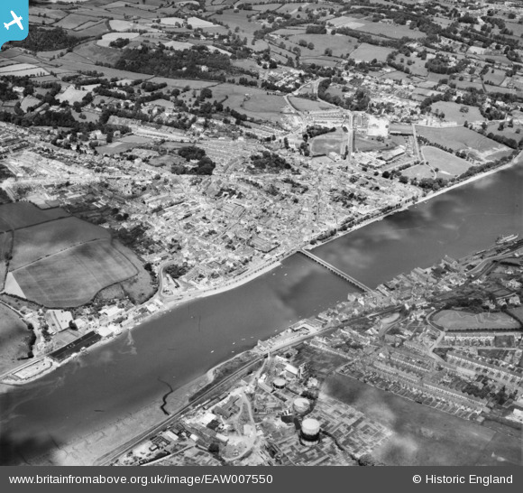
EAW007550 ENGLAND (1947). Bideford Bridge and the town, Bideford, 1947
© Copyright OpenStreetMap contributors and licensed by the OpenStreetMap Foundation. 2026. Cartography is licensed as CC BY-SA.
Nearby Images (10)
EAW007550

EPW039894

EPW033216

EAW053028

EPW059675

EPW033218

EAW031034

EPW039893

EPW039892

EPW033215

Details
| Title | [EAW007550] Bideford Bridge and the town, Bideford, 1947 |
| Reference | EAW007550 |
| Date | 25-June-1947 |
| Link | |
| Place name | BIDEFORD |
| Parish | BIDEFORD |
| District | |
| Country | ENGLAND |
| Easting / Northing | 245371, 126451 |
| Longitude / Latitude | -4.2047330030382, 51.016078778369 |
| National Grid Reference | SS454265 |
Pins

Matt |
Friday 21st of September 2018 11:12:05 AM | |

Sparky |
Tuesday 3rd of October 2017 12:15:30 AM | |
|
Hilary |
Sunday 23rd of February 2014 11:37:26 PM | |
|
TomRobin |
Friday 22nd of November 2013 05:19:04 PM | |
|
TomRobin |
Friday 22nd of November 2013 09:17:16 AM |