
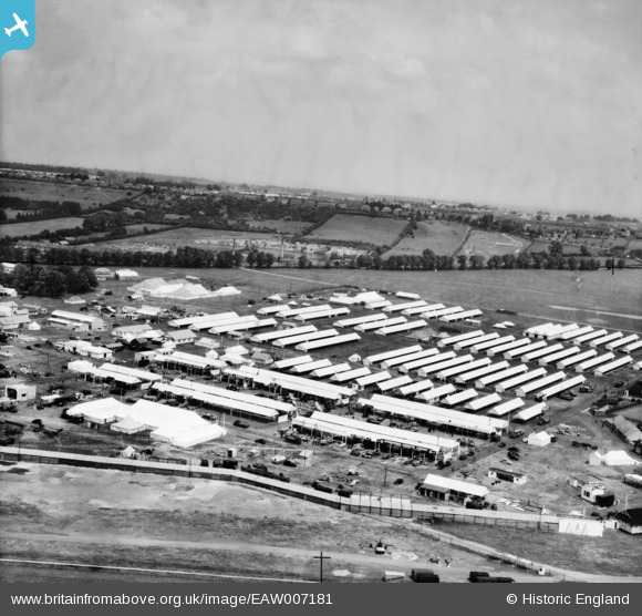
EAW007181 ENGLAND (1947). Lincoln, Setting up for the Royal Agricultural Show on West Common, from the south-west, 1947
© Copyright OpenStreetMap contributors and licensed by the OpenStreetMap Foundation. 2026. Cartography is licensed as CC BY-SA.
Nearby Images (11)
EAW007181

EAW007167

EAW007170

EAW007174

EAW007177

EAW007185

EAW007173

EAW007169

EAW007172

EAW007176

EAW007168

Details
| Title | [EAW007181] Lincoln, Setting up for the Royal Agricultural Show on West Common, from the south-west, 1947 |
| Reference | EAW007181 |
| Date | 25-June-1947 |
| Link | |
| Place name | LINCOLN |
| Parish | |
| District | |
| Country | ENGLAND |
| Easting / Northing | 496229, 372106 |
| Longitude / Latitude | -0.55801978053348, 53.236972805862 |
| National Grid Reference | SK962721 |
Pins

redmist |
Thursday 10th of March 2022 05:02:18 PM |