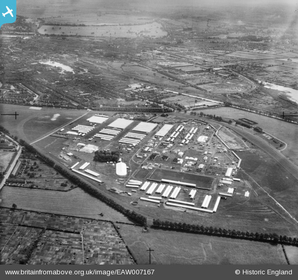
EAW007167 ENGLAND (1947). The Royal Agricultural Show Ground at West Common and environs, Lincoln, 1947
© Copyright OpenStreetMap contributors and licensed by the OpenStreetMap Foundation. 2026. Cartography is licensed as CC BY-SA.
Nearby Images (10)
Details
| Title | [EAW007167] The Royal Agricultural Show Ground at West Common and environs, Lincoln, 1947 |
| Reference | EAW007167 |
| Date | 25-June-1947 |
| Link | |
| Place name | LINCOLN |
| Parish | |
| District | |
| Country | ENGLAND |
| Easting / Northing | 496231, 372040 |
| Longitude / Latitude | -0.55800975876543, 53.236379300744 |
| National Grid Reference | SK962720 |
Pins

redmist |
Tuesday 30th of July 2019 01:09:15 PM |


![[EAW007167] The Royal Agricultural Show Ground at West Common and environs, Lincoln, 1947](http://britainfromabove.org.uk/sites/all/libraries/aerofilms-images/public/100x100/EAW/007/EAW007167.jpg)
![[EAW007170] The Royal Agricultural Show Ground at West Common and environs, Lincoln, from the south-east, 1947](http://britainfromabove.org.uk/sites/all/libraries/aerofilms-images/public/100x100/EAW/007/EAW007170.jpg)
![[EAW007181] Lincoln, Setting up for the Royal Agricultural Show on West Common, from the south-west, 1947](http://britainfromabove.org.uk/sites/all/libraries/aerofilms-images/public/100x100/EAW/007/EAW007181.jpg)
![[EAW007174] Lincoln, Setting up for the Royal Agricultural Show on West Common, 1947](http://britainfromabove.org.uk/sites/all/libraries/aerofilms-images/public/100x100/EAW/007/EAW007174.jpg)
![[EAW007176] Lincoln, Setting up for the Royal Agricultural Show on West Common, from the south, 1947](http://britainfromabove.org.uk/sites/all/libraries/aerofilms-images/public/100x100/EAW/007/EAW007176.jpg)
![[EAW007173] Lincoln, Setting up for the Royal Agricultural Show on West Common, 1947](http://britainfromabove.org.uk/sites/all/libraries/aerofilms-images/public/100x100/EAW/007/EAW007173.jpg)
![[EAW007177] The Royal Agricultural Show Ground at West Common and the city, Lincoln, from the north-west, 1947](http://britainfromabove.org.uk/sites/all/libraries/aerofilms-images/public/100x100/EAW/007/EAW007177.jpg)
![[EAW007185] Lincoln, Setting up for the Royal Agricultural Show on West Common, 1947](http://britainfromabove.org.uk/sites/all/libraries/aerofilms-images/public/100x100/EAW/007/EAW007185.jpg)
![[EAW007169] The Royal Agricultural Show Ground at West Common and environs, Lincoln, from the north-east, 1947](http://britainfromabove.org.uk/sites/all/libraries/aerofilms-images/public/100x100/EAW/007/EAW007169.jpg)
![[EAW007172] The Royal Agricultural Show Ground at West Common and environs, Lincoln, from the north-east, 1947](http://britainfromabove.org.uk/sites/all/libraries/aerofilms-images/public/100x100/EAW/007/EAW007172.jpg)