
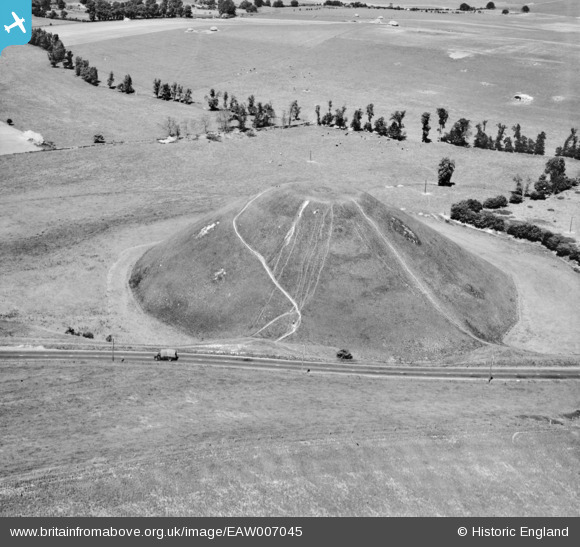
EAW007045 ENGLAND (1947). Silbury Hill, Avebury, 1947
© Copyright OpenStreetMap contributors and licensed by the OpenStreetMap Foundation. 2026. Cartography is licensed as CC BY-SA.
Nearby Images (13)
EAW007045

EAW034892

EAW034893

EAW049149

EAW034894

EAW007044

EAW034896

EAW034895

EAW007043

EAW034891

EAW049148

EAW002275

EAW049150

Details
| Title | [EAW007045] Silbury Hill, Avebury, 1947 |
| Reference | EAW007045 |
| Date | 11-June-1947 |
| Link | |
| Place name | AVEBURY |
| Parish | AVEBURY |
| District | |
| Country | ENGLAND |
| Easting / Northing | 409986, 168499 |
| Longitude / Latitude | -1.8563892902775, 51.414927608818 |
| National Grid Reference | SU100685 |
Pins

Vauni |
Tuesday 5th of February 2019 02:24:30 PM |
User Comment Contributions
Silbury Hill 28/12/2007 |

Class31 |
Saturday 23rd of November 2013 05:09:44 PM |