
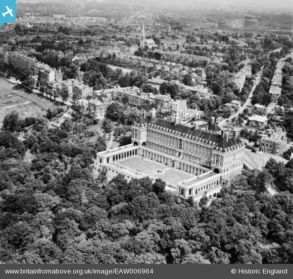
EAW006964 ENGLAND (1947). The Star and Garter Home, Richmond Hill, 1947
© Copyright OpenStreetMap contributors and licensed by the OpenStreetMap Foundation. 2026. Cartography is licensed as CC BY-SA.
Nearby Images (15)
EAW006964

EAW006963

EPW022833

EPR000652

EAW006962

EPW022834

EPW010984

EAW006965

EPW001697

EAW006954

EAW006951

EAW006952

EAW006961

EAW006953

EAW006960

Details
| Title | [EAW006964] The Star and Garter Home, Richmond Hill, 1947 |
| Reference | EAW006964 |
| Date | 16-June-1947 |
| Link | |
| Place name | RICHMOND HILL |
| Parish | |
| District | |
| Country | ENGLAND |
| Easting / Northing | 518395, 173765 |
| Longitude / Latitude | -0.29597806467039, 51.4499872271 |
| National Grid Reference | TQ184738 |
Pins
Be the first to add a comment to this image!