
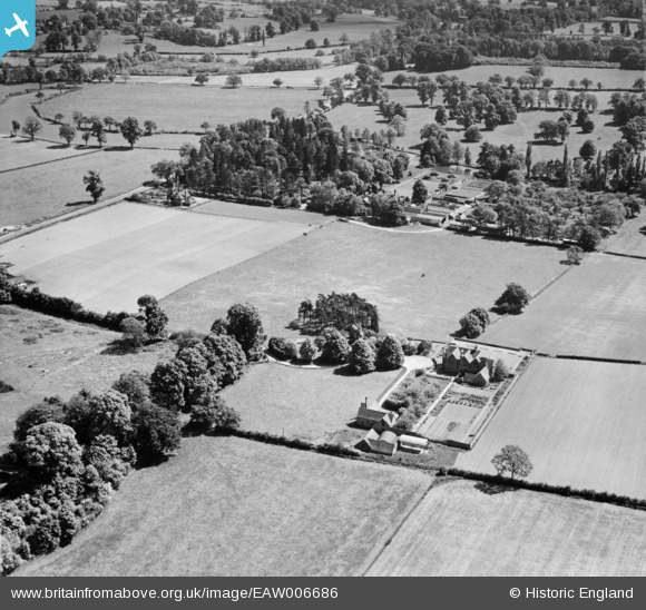
EAW006686 ENGLAND (1947). Stone Edge, Leek Wootton, 1947
© Copyright OpenStreetMap contributors and licensed by the OpenStreetMap Foundation. 2025. Cartography is licensed as CC BY-SA.
Nearby Images (5)
EAW006686

EAW006683

EAW006684

EAW006676

EAW006680

Details
| Title | [EAW006686] Stone Edge, Leek Wootton, 1947 |
| Reference | EAW006686 |
| Date | 28-May-1947 |
| Link | |
| Place name | LEEK WOOTTON |
| Parish | LEEK WOOTTON AND GUY'S CLIFFE |
| District | |
| Country | ENGLAND |
| Easting / Northing | 428747, 268564 |
| Longitude / Latitude | -1.5782572767184, 52.314042002631 |
| National Grid Reference | SP287686 |
Pins
Be the first to add a comment to this image!