
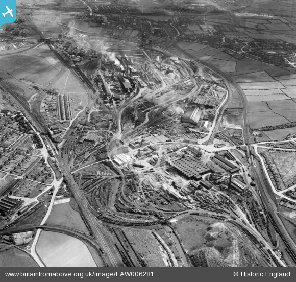
EAW006281 ENGLAND (1947). The Staveley Iron Works, Staveley, 1947
© Copyright OpenStreetMap contributors and licensed by the OpenStreetMap Foundation. 2026. Cartography is licensed as CC BY-SA.
Nearby Images (14)
EAW006281

EAW006283

EAW006282

EAW006280

EPW057337

EAW044345

EPW057351

EAW003060

EAW043845

EPW041670

EPW057341

EPW041672

EPW041667

EAW003058

Details
| Title | [EAW006281] The Staveley Iron Works, Staveley, 1947 |
| Reference | EAW006281 |
| Date | 25-May-1947 |
| Link | |
| Place name | STAVELEY |
| Parish | STAVELEY |
| District | |
| Country | ENGLAND |
| Easting / Northing | 441720, 374935 |
| Longitude / Latitude | -1.3743716977816, 53.269485580058 |
| National Grid Reference | SK417749 |
Pins

grey |
Tuesday 11th of April 2017 04:32:39 PM |