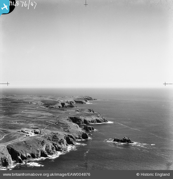
EAW004876 ENGLAND (1947). The coastline from Land's End to Gwennap Head, Land's End, from the north-west, 1947
    © Copyright OpenStreetMap contributors and licensed by the OpenStreetMap Foundation. 2025. Cartography is licensed as CC BY-SA.
  
Details
| Title | [EAW004876] The coastline from Land's End to Gwennap Head, Land's End, from the north-west, 1947 | 
| Reference | EAW004876 | 
| Date | May-1947 | 
| Link | |
| Place name | LAND'S END | 
| Parish | SENNEN | 
| District | |
| Country | ENGLAND | 
| Easting / Northing | 134226, 24715 | 
| Longitude / Latitude | -5.7140752317272, 50.062428352836 | 
| National Grid Reference | SW342247 | 
Pins
Be the first to add a comment to this image!
 
             
  ![[EAW004876] The coastline from Land's End to Gwennap Head, Land's End, from the north-west, 1947](http://britainfromabove.org.uk/sites/all/libraries/aerofilms-images/public/100x100/EAW/004/EAW004876.jpg) 
  
                                          ![[EPW039852] Carn Greeb, Land's End, 1932. This image has been produced from a copy-negative.](http://britainfromabove.org.uk/sites/all/libraries/aerofilms-images/public/100x100/EPW/039/EPW039852.jpg) 
 ![[EAW004875] Land's End and Whitesand Bay, Land's End, from the south-west, 1947](http://britainfromabove.org.uk/sites/all/libraries/aerofilms-images/public/100x100/EAW/004/EAW004875.jpg) 
 ![[EPW059873] The Armed Knight looking along the coastline to The Peal and beyond, Land's End, from the south-west, 1938](http://britainfromabove.org.uk/sites/all/libraries/aerofilms-images/public/100x100/EPW/059/EPW059873.jpg)