
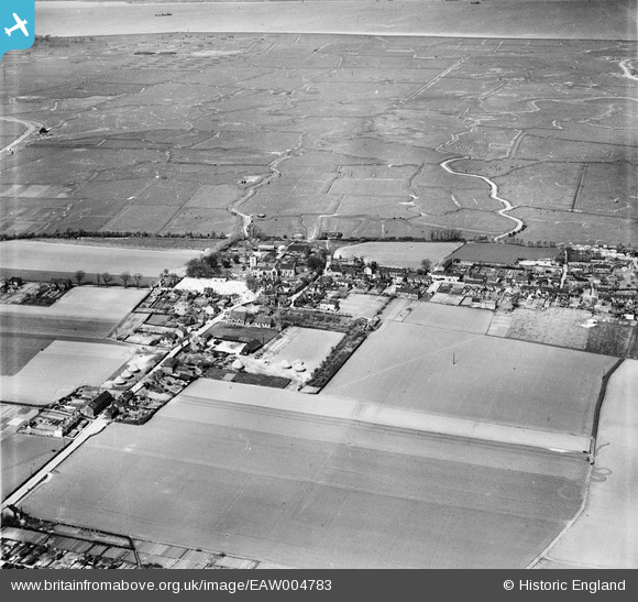
EAW004783 ENGLAND (1947). The village and Cliffe Marshes, Cliffe, from the south, 1947
© Copyright OpenStreetMap contributors and licensed by the OpenStreetMap Foundation. 2026. Cartography is licensed as CC BY-SA.
Nearby Images (4)
EAW004783

EAW004790

EAW004789

EAW004786

Details
| Title | [EAW004783] The village and Cliffe Marshes, Cliffe, from the south, 1947 |
| Reference | EAW004783 |
| Date | April-1947 |
| Link | |
| Place name | CLIFFE |
| Parish | CLIFFE AND CLIFFE WOODS |
| District | |
| Country | ENGLAND |
| Easting / Northing | 573705, 176269 |
| Longitude / Latitude | 0.50062594504582, 51.458218968529 |
| National Grid Reference | TQ737763 |
Pins

Flatcap |
Sunday 21st of December 2014 12:54:15 PM |