
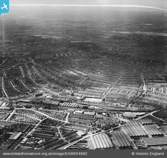
EAW004682 ENGLAND (1947). The city, Derby, from the south-east, 1947. This image was marked by Aerofilms Ltd for photo editing.
© Copyright OpenStreetMap contributors and licensed by the OpenStreetMap Foundation. 2026. Cartography is licensed as CC BY-SA.
Nearby Images (35)
EAW004682

EPW016995

EPW046668

EPW005809

EAW002477

EPW005807

EAW044385

EAW002480

EPW020802

EPW016993

EPW020799

EAW013121

EAW044380

EPW005810

EAW013120

EPW046667

EAW013122

EAW004680

EAW044381

EAW002479

EAW004679

EPW020805

EPW046665

EPW046669

EAW002481

EAW004681

EAW004677

EPW016991

EAW002476

EPW020798

EAW044382

EAW004678

EPW046664

EAW002478

EPW046666

Details
| Title | [EAW004682] The city, Derby, from the south-east, 1947. This image was marked by Aerofilms Ltd for photo editing. |
| Reference | EAW004682 |
| Date | 22-May-1947 |
| Link | |
| Place name | DERBY |
| Parish | |
| District | |
| Country | ENGLAND |
| Easting / Northing | 436006, 334189 |
| Longitude / Latitude | -1.4646186311561, 52.903610419667 |
| National Grid Reference | SK360342 |
Pins

redmist |
Saturday 22nd of June 2019 09:13:59 PM | |
|
redmist |
Saturday 22nd of June 2019 09:07:08 PM | |

Peter Kazmierczak |
Thursday 12th of September 2013 10:17:55 PM |
User Comment Contributions
Derby didn't become a city until 1977, so the title isn't strictly correct. |
Peter Kazmierczak |
Thursday 12th of September 2013 10:15:02 PM |