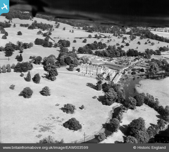
EAW003599 ENGLAND (1947). Stoneleigh Abbey, Stoneleigh, 1947
© Copyright OpenStreetMap contributors and licensed by the OpenStreetMap Foundation. 2024. Cartography is licensed as CC BY-SA.
Nearby Images (5)
Details
| Title | [EAW003599] Stoneleigh Abbey, Stoneleigh, 1947 |
| Reference | EAW003599 |
| Date | March-1947 |
| Link | |
| Place name | STONELEIGH |
| Parish | STONELEIGH |
| District | |
| Country | ENGLAND |
| Easting / Northing | 431826, 271252 |
| Longitude / Latitude | -1.5328328054212, 52.338039760937 |
| National Grid Reference | SP318713 |
Pins
Be the first to add a comment to this image!


![[EAW003599] Stoneleigh Abbey, Stoneleigh, 1947](http://britainfromabove.org.uk/sites/all/libraries/aerofilms-images/public/100x100/EAW/003/EAW003599.jpg)
![[EAW003598] Stoneleigh Abbey, Stoneleigh, from the south-west, 1947](http://britainfromabove.org.uk/sites/all/libraries/aerofilms-images/public/100x100/EAW/003/EAW003598.jpg)
![[EAW025684] Stoneleigh Abbey (site of), Stoneleigh, from the south, 1949. This image has been produced from a damaged negative.](http://britainfromabove.org.uk/sites/all/libraries/aerofilms-images/public/100x100/EAW/025/EAW025684.jpg)
![[EAW025683] Stoneleigh Abbey (site of), Stoneleigh, from the north, 1949. This image has been produced from a damaged negative.](http://britainfromabove.org.uk/sites/all/libraries/aerofilms-images/public/100x100/EAW/025/EAW025683.jpg)
![[EAW003597] Stoneleigh Abbey, Stoneleigh, from the north-west, 1947](http://britainfromabove.org.uk/sites/all/libraries/aerofilms-images/public/100x100/EAW/003/EAW003597.jpg)