
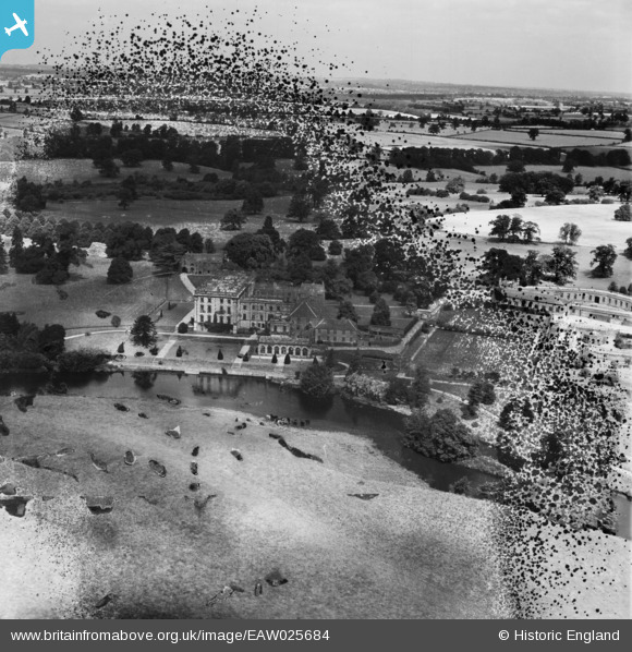
EAW025684 ENGLAND (1949). Stoneleigh Abbey (site of), Stoneleigh, from the south, 1949. This image has been produced from a damaged negative.
© Copyright OpenStreetMap contributors and licensed by the OpenStreetMap Foundation. 2026. Cartography is licensed as CC BY-SA.
Nearby Images (6)
EAW025684
, Stoneleigh, from the south, 1949. This image has been produced from a damaged negative.")
EAW003598

EAW003599

EAW025687

EAW025683
, Stoneleigh, from the north, 1949. This image has been produced from a damaged negative.")
EAW025686

Details
| Title | [EAW025684] Stoneleigh Abbey (site of), Stoneleigh, from the south, 1949. This image has been produced from a damaged negative. |
| Reference | EAW025684 |
| Date | 4-August-1949 |
| Link | |
| Place name | STONELEIGH |
| Parish | STONELEIGH |
| District | |
| Country | ENGLAND |
| Easting / Northing | 431898, 271148 |
| Longitude / Latitude | -1.5317858462244, 52.337100521611 |
| National Grid Reference | SP319711 |


