
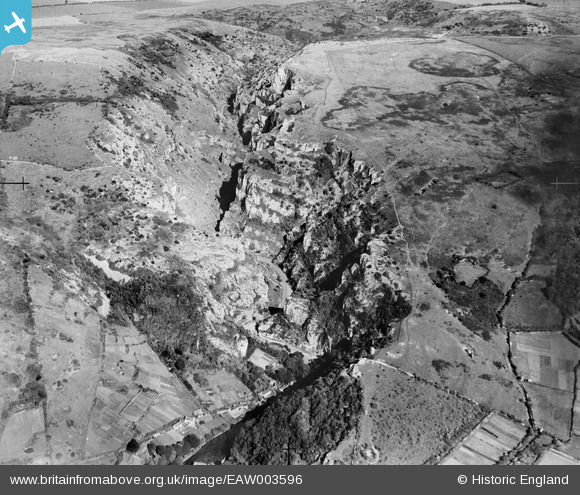
EAW003596 ENGLAND (1947). Cheddar Gorge, Cheddar, 1947
© Copyright OpenStreetMap contributors and licensed by the OpenStreetMap Foundation. 2026. Cartography is licensed as CC BY-SA.
Nearby Images (7)
EAW003596

EAW004866

EAW025160

EAW004865

EPW011750

EPW033371

EAW025163

Details
| Title | [EAW003596] Cheddar Gorge, Cheddar, 1947 |
| Reference | EAW003596 |
| Date | March-1947 |
| Link | |
| Place name | CHEDDAR |
| Parish | CHEDDAR |
| District | |
| Country | ENGLAND |
| Easting / Northing | 346923, 154077 |
| Longitude / Latitude | -2.7611245903886, 51.282848617645 |
| National Grid Reference | ST469541 |
Pins

Alan McFaden |
Saturday 19th of October 2013 10:26:42 PM | |
|
Alan McFaden |
Saturday 19th of October 2013 10:24:06 PM |

