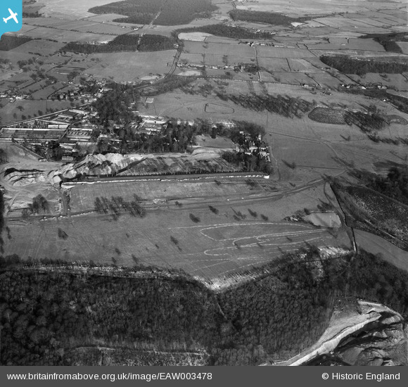
EAW003478 ENGLAND (1947). Wentworth Park and Wentworth Woodhouse, Wentworth, 1947
© Copyright OpenStreetMap contributors and licensed by the OpenStreetMap Foundation. 2025. Cartography is licensed as CC BY-SA.
Nearby Images (8)
Details
| Title | [EAW003478] Wentworth Park and Wentworth Woodhouse, Wentworth, 1947 |
| Reference | EAW003478 |
| Date | 12-January-1947 |
| Link | |
| Place name | WENTWORTH |
| Parish | WENTWORTH |
| District | |
| Country | ENGLAND |
| Easting / Northing | 439379, 397508 |
| Longitude / Latitude | -1.4066618511427, 53.472577252084 |
| National Grid Reference | SK394975 |
Pins
 redmist |
Monday 5th of November 2018 10:31:08 PM | |
 redmist |
Monday 5th of November 2018 10:28:22 PM |


![[EAW003478] Wentworth Park and Wentworth Woodhouse, Wentworth, 1947](http://britainfromabove.org.uk/sites/all/libraries/aerofilms-images/public/100x100/EAW/003/EAW003478.jpg)
![[EAW006263] Quarrying around Wentworth Woodhouse Gardens, Wentworth, 1947](http://britainfromabove.org.uk/sites/all/libraries/aerofilms-images/public/100x100/EAW/006/EAW006263.jpg)
![[EAW005598] Opencast coal mining adjacent to Wentworth Woodhouse, Wentworth, 1947](http://britainfromabove.org.uk/sites/all/libraries/aerofilms-images/public/100x100/EAW/005/EAW005598.jpg)
![[EAW003470] Wentworth Park and surrounding countryside, Wentworth, 1947](http://britainfromabove.org.uk/sites/all/libraries/aerofilms-images/public/100x100/EAW/003/EAW003470.jpg)
![[EAW006262] Quarrying around Wentworth Woodhouse Gardens, Wentworth, 1947](http://britainfromabove.org.uk/sites/all/libraries/aerofilms-images/public/100x100/EAW/006/EAW006262.jpg)
![[EAW005599] Opencast coal mining adjacent to Wentworth Woodhouse, Wentworth, 1947](http://britainfromabove.org.uk/sites/all/libraries/aerofilms-images/public/100x100/EAW/005/EAW005599.jpg)
![[EPW015433] Wentworth Woodhouse, Wentworth Park, 1926](http://britainfromabove.org.uk/sites/all/libraries/aerofilms-images/public/100x100/EPW/015/EPW015433.jpg)
![[EAW005600] Opencast coal mining adjacent to Wentworth Woodhouse, Wentworth, 1947](http://britainfromabove.org.uk/sites/all/libraries/aerofilms-images/public/100x100/EAW/005/EAW005600.jpg)