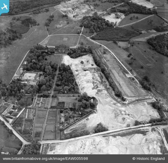
EAW005598 ENGLAND (1947). Opencast coal mining adjacent to Wentworth Woodhouse, Wentworth, 1947
© Copyright OpenStreetMap contributors and licensed by the OpenStreetMap Foundation. 2024. Cartography is licensed as CC BY-SA.
Nearby Images (7)
Details
| Title | [EAW005598] Opencast coal mining adjacent to Wentworth Woodhouse, Wentworth, 1947 |
| Reference | EAW005598 |
| Date | 15-May-1947 |
| Link | |
| Place name | WENTWORTH |
| Parish | WENTWORTH |
| District | |
| Country | ENGLAND |
| Easting / Northing | 439276, 397674 |
| Longitude / Latitude | -1.408192939988, 53.474077124595 |
| National Grid Reference | SK393977 |
Pins
Be the first to add a comment to this image!


![[EAW005598] Opencast coal mining adjacent to Wentworth Woodhouse, Wentworth, 1947](http://britainfromabove.org.uk/sites/all/libraries/aerofilms-images/public/100x100/EAW/005/EAW005598.jpg)
![[EAW005599] Opencast coal mining adjacent to Wentworth Woodhouse, Wentworth, 1947](http://britainfromabove.org.uk/sites/all/libraries/aerofilms-images/public/100x100/EAW/005/EAW005599.jpg)
![[EAW006262] Quarrying around Wentworth Woodhouse Gardens, Wentworth, 1947](http://britainfromabove.org.uk/sites/all/libraries/aerofilms-images/public/100x100/EAW/006/EAW006262.jpg)
![[EAW005600] Opencast coal mining adjacent to Wentworth Woodhouse, Wentworth, 1947](http://britainfromabove.org.uk/sites/all/libraries/aerofilms-images/public/100x100/EAW/005/EAW005600.jpg)
![[EAW006263] Quarrying around Wentworth Woodhouse Gardens, Wentworth, 1947](http://britainfromabove.org.uk/sites/all/libraries/aerofilms-images/public/100x100/EAW/006/EAW006263.jpg)
![[EAW006264] Quarrying around Wentworth Woodhouse Gardens, Wentworth, 1947](http://britainfromabove.org.uk/sites/all/libraries/aerofilms-images/public/100x100/EAW/006/EAW006264.jpg)
![[EAW003478] Wentworth Park and Wentworth Woodhouse, Wentworth, 1947](http://britainfromabove.org.uk/sites/all/libraries/aerofilms-images/public/100x100/EAW/003/EAW003478.jpg)