
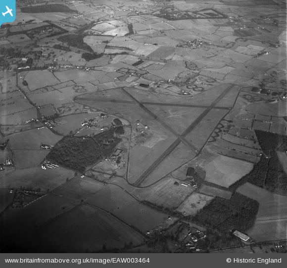
EAW003464 ENGLAND (1947). London Stansted Airport, Stansted Mountfitchet, 1947
© Copyright OpenStreetMap contributors and licensed by the OpenStreetMap Foundation. 2026. Cartography is licensed as CC BY-SA.
Nearby Images (6)
EAW003464

EAW003460

EAW003463

EAW003455

EAW003456

EAW003459

Details
| Title | [EAW003464] London Stansted Airport, Stansted Mountfitchet, 1947 |
| Reference | EAW003464 |
| Date | 1-January-1947 |
| Link | |
| Place name | STANSTED MOUNTFITCHET |
| Parish | STANSTED MOUNTFITCHET |
| District | |
| Country | ENGLAND |
| Easting / Northing | 553119, 222743 |
| Longitude / Latitude | 0.22490200375362, 51.881755767277 |
| National Grid Reference | TL531227 |
Pins

Jim C |
Tuesday 16th of December 2014 10:48:25 PM |