
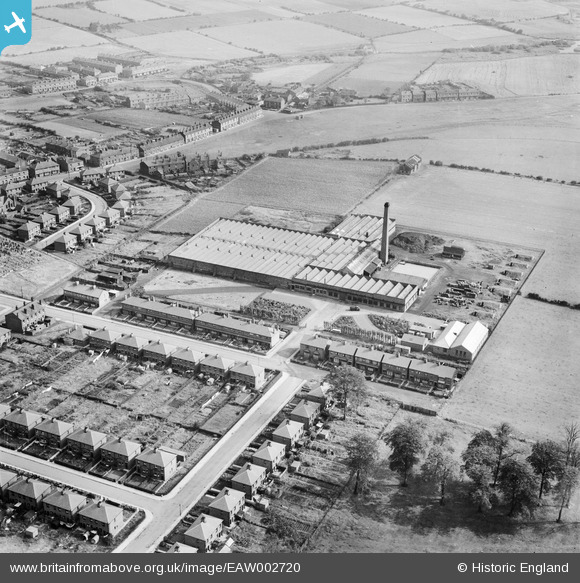
EAW002720 ENGLAND (1946). The Makerfield Cotton Weaving Mill, Ashton-in-Makerfield, 1946
© Copyright OpenStreetMap contributors and licensed by the OpenStreetMap Foundation. 2025. Cartography is licensed as CC BY-SA.
Nearby Images (10)
EAW002720

EAW002719

EAW002724

EAW002725

EAW002727

EAW002723

EAW002728

EAW002726

EAW002721

EAW002722

Details
| Title | [EAW002720] The Makerfield Cotton Weaving Mill, Ashton-in-Makerfield, 1946 |
| Reference | EAW002720 |
| Date | 12-September-1946 |
| Link | |
| Place name | ASHTON-IN-MAKERFIELD |
| Parish | |
| District | |
| Country | ENGLAND |
| Easting / Northing | 358022, 398660 |
| Longitude / Latitude | -2.6326497352427, 53.482731685312 |
| National Grid Reference | SJ580987 |
Pins

redmist |
Saturday 15th of October 2022 11:22:26 AM | |
|
redmist |
Saturday 15th of October 2022 11:22:00 AM | |
|
redmist |
Saturday 15th of October 2022 11:21:34 AM | |
|
adamw66 |
Monday 11th of March 2019 01:38:32 PM | |
|
adamw66 |
Monday 11th of March 2019 01:37:47 PM | |
|
adamw66 |
Monday 11th of March 2019 01:37:27 PM | |
|
adamw66 |
Monday 11th of March 2019 01:36:52 PM |