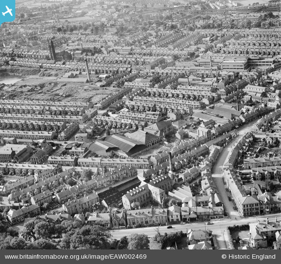
EAW002469 ENGLAND (1946). Ernest Turner Spa Lane Mills and environs, Derby, 1946
© Copyright OpenStreetMap contributors and licensed by the OpenStreetMap Foundation. 2026. Cartography is licensed as CC BY-SA.
Nearby Images (8)
Details
| Title | [EAW002469] Ernest Turner Spa Lane Mills and environs, Derby, 1946 |
| Reference | EAW002469 |
| Date | 6-September-1946 |
| Link | |
| Place name | DERBY |
| Parish | |
| District | |
| Country | ENGLAND |
| Easting / Northing | 434741, 335491 |
| Longitude / Latitude | -1.4832880856978, 52.915398657932 |
| National Grid Reference | SK347355 |
Pins

Old Derby |
Tuesday 18th of August 2020 02:56:23 PM | |

Sparky |
Sunday 17th of September 2017 03:03:38 PM | |

Steve H |
Thursday 12th of November 2015 12:42:55 AM | |

Brian Hunt |
Thursday 17th of July 2014 05:13:44 PM | |

Brian Hunt |
Thursday 17th of July 2014 05:13:01 PM | |

Brian Hunt |
Thursday 17th of July 2014 05:12:26 PM | |

Brian Hunt |
Thursday 17th of July 2014 05:11:27 PM | |

Brian Hunt |
Thursday 17th of July 2014 05:09:21 PM | |

Al |
Tuesday 10th of December 2013 10:24:51 PM | |
on stockbrook street derby site now occupied by the Becket childrens centre |

Al |
Tuesday 10th of December 2013 10:28:57 PM |
I think this is the Co Op Paintworks on Stcokbrook Street. it was demolished and the school was put there. |

Brian Hunt |
Thursday 17th of July 2014 05:08:04 PM |

Al |
Tuesday 10th of December 2013 10:24:27 PM | |

Al |
Tuesday 10th of December 2013 10:24:01 PM |


![[EAW002469] Ernest Turner Spa Lane Mills and environs, Derby, 1946](http://britainfromabove.org.uk/sites/all/libraries/aerofilms-images/public/100x100/EAW/002/EAW002469.jpg)
![[EAW002471] Ernest Turner Spa Lane Mills and environs, Derby, 1946](http://britainfromabove.org.uk/sites/all/libraries/aerofilms-images/public/100x100/EAW/002/EAW002471.jpg)
![[EAW002474] Ernest Turner Spa Lane Mills and Abbey Street, Derby, 1946](http://britainfromabove.org.uk/sites/all/libraries/aerofilms-images/public/100x100/EAW/002/EAW002474.jpg)
![[EAW002475] Ernest Turner Spa Lane Mills and Abbey Street, Derby, 1946](http://britainfromabove.org.uk/sites/all/libraries/aerofilms-images/public/100x100/EAW/002/EAW002475.jpg)
![[EPW055019] The Derby Brick Co Ltd Brickworks, Abbey Street and the city, Derby, from the south-west, 1937](http://britainfromabove.org.uk/sites/all/libraries/aerofilms-images/public/100x100/EPW/055/EPW055019.jpg)
![[EAW002472] Ernest Turner Spa Lane Mills, Burton Road and environs, Derby, 1946](http://britainfromabove.org.uk/sites/all/libraries/aerofilms-images/public/100x100/EAW/002/EAW002472.jpg)
![[EAW002470] Burton Road at Spa Lane and environs, Derby, 1946](http://britainfromabove.org.uk/sites/all/libraries/aerofilms-images/public/100x100/EAW/002/EAW002470.jpg)
![[EAW002473] Ernest Turner Spa Lane Mills and Burton Road, Derby, 1946](http://britainfromabove.org.uk/sites/all/libraries/aerofilms-images/public/100x100/EAW/002/EAW002473.jpg)