
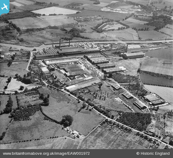
EAW001972 ENGLAND (1946). Aylesford Paper Mills, Ditton, 1946
© Copyright OpenStreetMap contributors and licensed by the OpenStreetMap Foundation. 2026. Cartography is licensed as CC BY-SA.
Nearby Images (14)
EAW001972

EAW001981

EPW047723

EPW047725

EPW047721

EAW001980

EPW047724

EPW047722

EPW047726

EAW001973

EAW018283
, Ditton, from the south-west, 1948. This image has been produced from a damaged negative.")
EAW018287

EAW018288

EAW018282

Details
| Title | [EAW001972] Aylesford Paper Mills, Ditton, 1946 |
| Reference | EAW001972 |
| Date | 25-July-1946 |
| Link | |
| Place name | DITTON |
| Parish | DITTON |
| District | |
| Country | ENGLAND |
| Easting / Northing | 571028, 159699 |
| Longitude / Latitude | 0.45414641766479, 51.310162635376 |
| National Grid Reference | TQ710597 |
Pins

Matt Aldred edob.mattaldred.com |
Saturday 28th of October 2023 12:02:46 PM | |

Sparky |
Monday 18th of September 2017 10:45:42 PM | |
|
Sparky |
Monday 18th of September 2017 10:44:49 PM | |

Dylan Moore |
Tuesday 15th of July 2014 02:26:47 AM |