
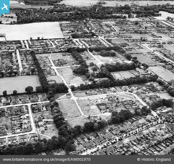
EAW001970 ENGLAND (1946). The Cottage Public House and environs, Thorpe St Andrew, 1946
© Copyright OpenStreetMap contributors and licensed by the OpenStreetMap Foundation. 2026. Cartography is licensed as CC BY-SA.
Nearby Images (8)
EAW001970

EAW001969

EAW001968

EAW001966

EAW001967

EAW001965

EAW001971

EAW001964

Details
| Title | [EAW001970] The Cottage Public House and environs, Thorpe St Andrew, 1946 |
| Reference | EAW001970 |
| Date | 25-July-1946 |
| Link | |
| Place name | THORPE ST ANDREW |
| Parish | THORPE ST. ANDREW |
| District | |
| Country | ENGLAND |
| Easting / Northing | 626448, 309791 |
| Longitude / Latitude | 1.3471776160114, 52.638175408478 |
| National Grid Reference | TG264098 |
Pins

SteveCBR |
Thursday 28th of March 2024 11:58:41 AM | |
|
SteveCBR |
Thursday 28th of March 2024 11:57:44 AM | |
|
SteveCBR |
Thursday 28th of March 2024 11:56:57 AM | |
|
SteveCBR |
Thursday 28th of March 2024 11:54:06 AM | |
|
SteveCBR |
Thursday 28th of March 2024 11:51:55 AM |