
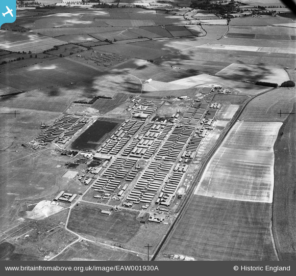
EAW001930A ENGLAND (1946). RAF Yatesbury, Yatesbury, 1946
© Copyright OpenStreetMap contributors and licensed by the OpenStreetMap Foundation. 2026. Cartography is licensed as CC BY-SA.
Nearby Images (5)
EAW001930A

EAW001926

EAW001929

EAW001928

EAW001927

Details
| Title | [EAW001930A] RAF Yatesbury, Yatesbury, 1946 |
| Reference | EAW001930A |
| Date | 12-July-1946 |
| Link | |
| Place name | YATESBURY |
| Parish | CHERHILL |
| District | |
| Country | ENGLAND |
| Easting / Northing | 406639, 170243 |
| Longitude / Latitude | -1.9044904076335, 51.430659814486 |
| National Grid Reference | SU066702 |
Pins

Harpie |
Wednesday 25th of February 2015 10:47:09 AM | |
|
Martin D |
Saturday 26th of April 2014 01:00:02 AM | |
|
primlea |
Monday 4th of November 2013 07:06:37 PM | |
|
primlea |
Monday 4th of November 2013 07:05:45 PM | |

Class31 |
Saturday 24th of August 2013 11:39:44 PM | |
|
Class31 |
Saturday 24th of August 2013 11:38:29 PM |
User Comment Contributions
We're really pleased to have the location for this group of images of Yatesbury Camp. The updated catalogue record will be posted here in due course. Yours, Katy Britain from Above Cataloguing Team Leader |
Katy Whitaker |
Tuesday 3rd of September 2013 12:26:10 PM |