
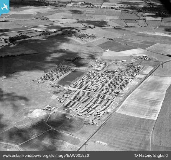
EAW001926 ENGLAND (1946). RAF Yatesbury, Yatesbury, 1946
© Copyright OpenStreetMap contributors and licensed by the OpenStreetMap Foundation. 2026. Cartography is licensed as CC BY-SA.
Nearby Images (5)
EAW001926

EAW001929

EAW001928

EAW001930A

EAW001927

Details
| Title | [EAW001926] RAF Yatesbury, Yatesbury, 1946 |
| Reference | EAW001926 |
| Date | 12-July-1946 |
| Link | |
| Place name | YATESBURY |
| Parish | CHERHILL |
| District | |
| Country | ENGLAND |
| Easting / Northing | 406632, 170346 |
| Longitude / Latitude | -1.9045891812389, 51.431586134329 |
| National Grid Reference | SU066703 |
Pins

Class31 |
Saturday 8th of February 2014 07:34:13 PM | |
|
Class31 |
Saturday 24th of August 2013 11:45:01 PM | |
|
Class31 |
Saturday 24th of August 2013 11:36:46 PM | |

bayleaf |
Friday 23rd of August 2013 03:57:57 PM |

User Comment Contributions
We're really pleased to have a location for this group of images of Yatesbury Camp. The updated catalogue record will be posted here in due course. Yours, Katy Britain from Above Cataloguing Team Leader |
Katy Whitaker |
Tuesday 3rd of September 2013 12:23:07 PM |