
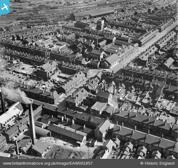
EAW001857 ENGLAND (1946). The Walsall Leather Dressing Co Works and the surrounding residential area, Walsall, 1946
© Copyright OpenStreetMap contributors and licensed by the OpenStreetMap Foundation. 2026. Cartography is licensed as CC BY-SA.
Nearby Images (17)
EAW001857

EAW001856

EAW001854

EAW001853

EAW001855

EAW001858

EAW001862

EAW001859

EAW001861

EAW001860

EAW039989

EAW039990

EAW039985

EAW039991

EAW039984

EAW039987

EAW039988

Details
| Title | [EAW001857] The Walsall Leather Dressing Co Works and the surrounding residential area, Walsall, 1946 |
| Reference | EAW001857 |
| Date | 12-July-1946 |
| Link | |
| Place name | WALSALL |
| Parish | |
| District | |
| Country | ENGLAND |
| Easting / Northing | 400770, 298443 |
| Longitude / Latitude | -1.9886343453287, 52.583438004865 |
| National Grid Reference | SP008984 |
Pins

KevTheBusDriver |
Sunday 2nd of May 2021 08:43:59 PM | |
|
KevTheBusDriver |
Friday 9th of April 2021 08:52:27 PM |
User Comment Contributions
This picture around Bridgeman Street, Queen Street etc is about as sharp as you can get, brilliant, can even see Anderson shelter in gardens. |
Sandwell Street Kid |
Friday 28th of March 2014 02:56:35 PM |