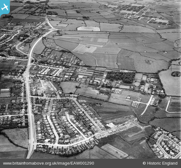
EAW001290 ENGLAND (1946). The residential area surrounding Cortsway, Kirkway and Greasby Road, Greasby, 1946
© Copyright OpenStreetMap contributors and licensed by the OpenStreetMap Foundation. 2026. Cartography is licensed as CC BY-SA.
Details
| Title | [EAW001290] The residential area surrounding Cortsway, Kirkway and Greasby Road, Greasby, 1946 |
| Reference | EAW001290 |
| Date | 24-June-1946 |
| Link | |
| Place name | GREASBY |
| Parish | |
| District | |
| Country | ENGLAND |
| Easting / Northing | 325816, 387903 |
| Longitude / Latitude | -3.1154120402816, 53.382494930562 |
| National Grid Reference | SJ258879 |
Pins

Longago |
Thursday 30th of March 2023 08:23:27 AM | |

Longago |
Thursday 30th of March 2023 08:22:06 AM | |

rosa |
Saturday 28th of January 2023 05:33:07 PM | |

JethroBodineJr |
Thursday 30th of September 2021 05:13:37 PM | |

JethroBodineJr |
Thursday 30th of September 2021 05:12:46 PM | |

SDIrwin |
Tuesday 14th of July 2020 07:51:37 PM | |

andy1742 |
Tuesday 15th of August 2017 10:25:15 PM | |

andy1742 |
Tuesday 15th of August 2017 10:22:14 PM | |

Alison_C |
Saturday 7th of November 2015 03:19:06 PM | |

Alison_C |
Saturday 7th of November 2015 03:18:19 PM | |

Alison_C |
Saturday 7th of November 2015 03:08:15 PM | |

Alison_C |
Saturday 7th of November 2015 03:04:25 PM | |

Alison_C |
Saturday 7th of November 2015 03:03:08 PM |


![[EAW001290] The residential area surrounding Cortsway, Kirkway and Greasby Road, Greasby, 1946](http://britainfromabove.org.uk/sites/all/libraries/aerofilms-images/public/100x100/EAW/001/EAW001290.jpg)
![[EAW001601] Greasby Road and environs, Greasby, 1946](http://britainfromabove.org.uk/sites/all/libraries/aerofilms-images/public/100x100/EAW/001/EAW001601.jpg)
![[EAW001602] Devonshire Road, Wood Lane and environs, Greasby, 1946](http://britainfromabove.org.uk/sites/all/libraries/aerofilms-images/public/100x100/EAW/001/EAW001602.jpg)