
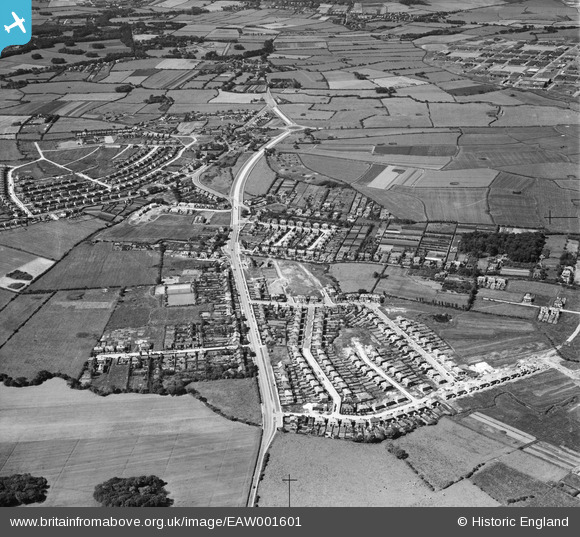
EAW001601 ENGLAND (1946). Greasby Road and environs, Greasby, 1946
© Copyright OpenStreetMap contributors and licensed by the OpenStreetMap Foundation. 2026. Cartography is licensed as CC BY-SA.
Nearby Images (2)
EAW001601

EAW001290

Details
| Title | [EAW001601] Greasby Road and environs, Greasby, 1946 |
| Reference | EAW001601 |
| Date | 11-July-1946 |
| Link | |
| Place name | GREASBY |
| Parish | |
| District | |
| Country | ENGLAND |
| Easting / Northing | 325912, 387691 |
| Longitude / Latitude | -3.1139191718252, 53.380602962523 |
| National Grid Reference | SJ259877 |
Pins

Gymbo |
Sunday 2nd of November 2014 10:22:12 AM | |
|
Paul Booth |
Wednesday 22nd of January 2014 12:05:09 AM | |
|
Paul Booth |
Wednesday 22nd of January 2014 12:03:20 AM |
