
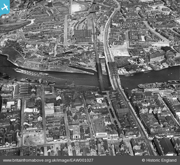
EAW001027 ENGLAND (1946). Wearmouth Bridge and the surrounding industrial and residential area, Sunderland, 1946
© Copyright OpenStreetMap contributors and licensed by the OpenStreetMap Foundation. 2026. Cartography is licensed as CC BY-SA.
Nearby Images (15)
EAW001027

EPW051127

EPW020544

EAW001026

EAW001028

EAW405804

EAW021466

EAW021454
 and assisting tugs on the River Wear by Wearmouth Bridge and Monkwearmouth Brewery, Monkwearmouth, 1949")
EAW022796

EAW022795

EAW022830

EPW010360

EAW022798

EAW021467

EAW022794

Details
| Title | [EAW001027] Wearmouth Bridge and the surrounding industrial and residential area, Sunderland, 1946 |
| Reference | EAW001027 |
| Date | 6-June-1946 |
| Link | |
| Place name | SUNDERLAND |
| Parish | |
| District | |
| Country | ENGLAND |
| Easting / Northing | 439596, 557423 |
| Longitude / Latitude | -1.3823281297979, 54.90986420585 |
| National Grid Reference | NZ396574 |
