
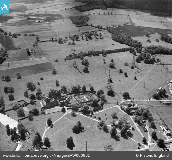
EAW000961 ENGLAND (1946). Chicksands Priory at RAF Chicksands and environs, Chicksands, 1946
© Copyright OpenStreetMap contributors and licensed by the OpenStreetMap Foundation. 2026. Cartography is licensed as CC BY-SA.
Nearby Images (4)
EAW000961

EAW000954

EAW050918

EAW000953

Details
| Title | [EAW000961] Chicksands Priory at RAF Chicksands and environs, Chicksands, 1946 |
| Reference | EAW000961 |
| Date | 28-May-1946 |
| Link | |
| Place name | CHICKSANDS |
| Parish | CAMPTON AND CHICKSANDS |
| District | |
| Country | ENGLAND |
| Easting / Northing | 511868, 239398 |
| Longitude / Latitude | -0.36876169299986, 52.041258741042 |
| National Grid Reference | TL119394 |
Pins

Matt Aldred edob.mattaldred.com |
Friday 8th of March 2024 01:59:03 PM | |
|
Matt Aldred edob.mattaldred.com |
Friday 6th of May 2022 08:20:33 PM | |

Charnie |
Saturday 27th of April 2019 11:12:55 AM | |

melgibbs |
Monday 6th of October 2014 10:40:47 AM |
User Comment Contributions
Chicksands Priory was a large Naval and RAF wireless listening station (Y Station) in WW2 |
stanames |
Saturday 28th of December 2013 07:19:12 PM |
Chicksands Priory was a large Naval and RAF listening station in WW2 and this image shows part of the large aerial field. |
stanames |
Saturday 28th of December 2013 07:18:26 PM |