
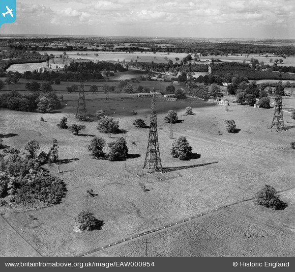
EAW000954 ENGLAND (1946). Radio masts at RAF Chicksands, Chicksands, from the south-west, 1946
© Copyright OpenStreetMap contributors and licensed by the OpenStreetMap Foundation. 2026. Cartography is licensed as CC BY-SA.
Nearby Images (2)
EAW000954

EAW000961

Details
| Title | [EAW000954] Radio masts at RAF Chicksands, Chicksands, from the south-west, 1946 |
| Reference | EAW000954 |
| Date | 28-May-1946 |
| Link | |
| Place name | CHICKSANDS |
| Parish | CAMPTON AND CHICKSANDS |
| District | |
| Country | ENGLAND |
| Easting / Northing | 511810, 239392 |
| Longitude / Latitude | -0.36960903031758, 52.041216515074 |
| National Grid Reference | TL118394 |
Pins
Be the first to add a comment to this image!
User Comment Contributions
RAF Chicksands was one of the "Y Stations" during WW2 intercepting enemy radio messages and passing them on to Bletchley Park. |

melgibbs |
Thursday 26th of February 2015 06:24:22 PM |
Chicksands Priory was a 12th century Gilbertine Priory & was sold to the War Office in 1938. For more details, see www.army.mod.uk/intelligence/32259.aspx and en.wikipedia.org/wiki/RAF_Chicksands. |
melgibbs |
Monday 6th of October 2014 10:30:12 AM |