
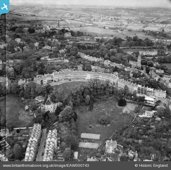
EAW000743 ENGLAND (1946). Lansdown Crescent and environs, Lansdown, from the south-west, 1946
© Copyright OpenStreetMap contributors and licensed by the OpenStreetMap Foundation. 2026. Cartography is licensed as CC BY-SA.
Nearby Images (5)
EAW000743

EAW000742

EPW001943

EPW001939

EPR000139

Details
| Title | [EAW000743] Lansdown Crescent and environs, Lansdown, from the south-west, 1946 |
| Reference | EAW000743 |
| Date | 9-May-1946 |
| Link | |
| Place name | LANSDOWN |
| Parish | |
| District | |
| Country | ENGLAND |
| Easting / Northing | 374609, 165962 |
| Longitude / Latitude | -2.3649681642317, 51.391632933178 |
| National Grid Reference | ST746660 |
Pins
Be the first to add a comment to this image!