
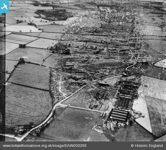
EAW000393 ENGLAND (1946). The Chatwood Safe Company Works and housing at Harlescott Crescent, Harlescott, 1946. This image has been produced from a damaged negative.
© Copyright OpenStreetMap contributors and licensed by the OpenStreetMap Foundation. 2026. Cartography is licensed as CC BY-SA.
Nearby Images (19)
EAW000393

EAW001109

EAW001107

EAW001110

EAW000396

EAW001106

EAW001621

EAW000397

EAW001623

EPW023304

EAW000394

EAW001624

EPW023301

EAW000398

EAW001625

EPW023300

EPW023303

EPW028836

EPW028832

Details
| Title | [EAW000393] The Chatwood Safe Company Works and housing at Harlescott Crescent, Harlescott, 1946. This image has been produced from a damaged negative. |
| Reference | EAW000393 |
| Date | 17-April-1946 |
| Link | |
| Place name | HARLESCOTT |
| Parish | SHREWSBURY |
| District | |
| Country | ENGLAND |
| Easting / Northing | 350420, 316085 |
| Longitude / Latitude | -2.7344513356265, 52.739779098696 |
| National Grid Reference | SJ504161 |
Pins
Be the first to add a comment to this image!