
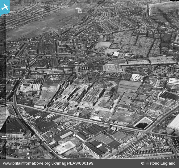
EAW000199 ENGLAND (1946). The Bakelite Works and the surrounding industrial area, Tyseley, 1946. This image has been produced from a damaged negative.
© Copyright OpenStreetMap contributors and licensed by the OpenStreetMap Foundation. 2026. Cartography is licensed as CC BY-SA.
Nearby Images (37)
EAW000199

EPW044572

EAW000201

EPW044573

EAW000200

EPW044575

EAW041909

EAW000197

EAW000198

EAW041907

EAW042221

EAW000195

EPW044569

EAW042220

EPW044574

EPW044571

EAW000203

EPW044568

EAW041911

EAW042223

EPW044576

EAW042224

EAW042222

EAW042228

EAW042227

EAW041905

EPW044570

EAW041912

EAW000202

EAW041906

EAW042225

EAW042226

EAW000196

EAW041908

EAW041910

EAW000194

EAW042229

Details
| Title | [EAW000199] The Bakelite Works and the surrounding industrial area, Tyseley, 1946. This image has been produced from a damaged negative. |
| Reference | EAW000199 |
| Date | 16-April-1946 |
| Link | |
| Place name | TYSELEY |
| Parish | |
| District | |
| Country | ENGLAND |
| Easting / Northing | 411336, 284452 |
| Longitude / Latitude | -1.833151571153, 52.457528557792 |
| National Grid Reference | SP113845 |
