
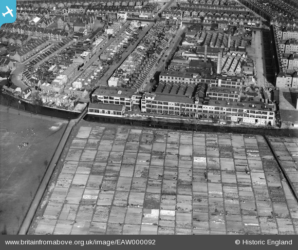
EAW000092 ENGLAND (1946). The A. H. Hunt Ltd Capacitor Works alongside the River Wandle, Earlsfield, 1946
© Copyright OpenStreetMap contributors and licensed by the OpenStreetMap Foundation. 2026. Cartography is licensed as CC BY-SA.
Nearby Images (25)
EAW000092

EAW000091

EAW000093

EPW031954

EAW000090

EAW000089

EPW031958

EPW031956

EPW031959

EPW031957

EPW031953

EAW000094

EPW031955

EPW060337

EPW058948

EPW058598

EPW058595

EPW060338

EPW060339

EPW058949

EPW060341

EPW058947

EPW060340

EPW060336

EPW058946

Details
| Title | [EAW000092] The A. H. Hunt Ltd Capacitor Works alongside the River Wandle, Earlsfield, 1946 |
| Reference | EAW000092 |
| Date | 1-April-1946 |
| Link | |
| Place name | EARLSFIELD |
| Parish | |
| District | |
| Country | ENGLAND |
| Easting / Northing | 525658, 173485 |
| Longitude / Latitude | -0.19159780549156, 51.44590511435 |
| National Grid Reference | TQ257735 |
Pins

Sparky |
Thursday 27th of July 2017 04:24:26 PM |