
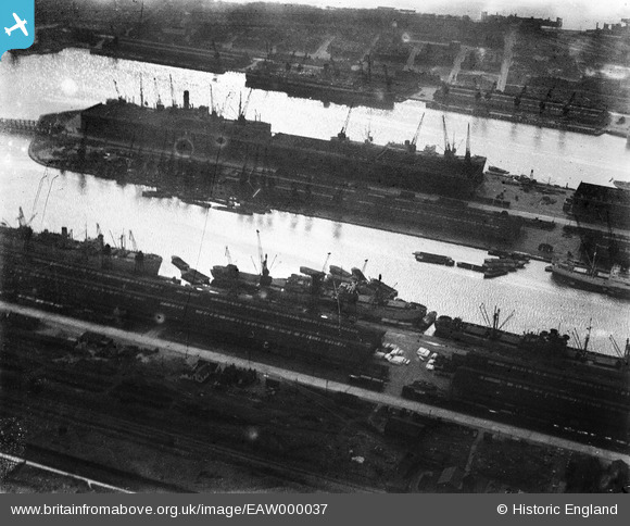
EAW000037 ENGLAND (1946). The King George V Dock and the Royal Albert Dock, Beckton, 1946. This image has been produced from a damaged negative.
© Copyright OpenStreetMap contributors and licensed by the OpenStreetMap Foundation. 2026. Cartography is licensed as CC BY-SA.
Nearby Images (19)
EAW000037

EAW021704

EAW021713

EAW008727

EPW005310

EAW021702

EPW010729

EPW032937

EAW022354

EPW044119

EAW021703

EAW008725

EPW010727

EAW022359

EPW032936

EAW000035

EAW005289

EAW000057

EAW000054

Details
| Title | [EAW000037] The King George V Dock and the Royal Albert Dock, Beckton, 1946. This image has been produced from a damaged negative. |
| Reference | EAW000037 |
| Date | 24-February-1946 |
| Link | |
| Place name | BECKTON |
| Parish | |
| District | |
| Country | ENGLAND |
| Easting / Northing | 543009, 180600 |
| Longitude / Latitude | 0.06082607489214, 51.50572966095 |
| National Grid Reference | TQ430806 |
Pins
Be the first to add a comment to this image!