
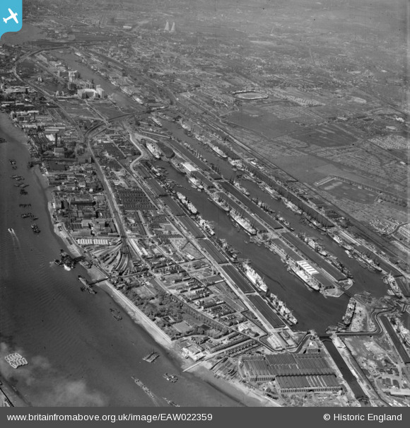
EAW022359 ENGLAND (1949). The Royal Docks and environs, North Woolwich, 1949
© Copyright OpenStreetMap contributors and licensed by the OpenStreetMap Foundation. 2026. Cartography is licensed as CC BY-SA.
Nearby Images (16)
EAW022359

EAW022354

EAW000035

EPW044119

EPW010729

EAW021702

EPW056681

EPW008890

EAW000052

EAW021704

EAW021713

EPW044116

EPW021370

EPW032930

EAW000037

EAW008727

Details
| Title | [EAW022359] The Royal Docks and environs, North Woolwich, 1949 |
| Reference | EAW022359 |
| Date | 19-April-1949 |
| Link | |
| Place name | NORTH WOOLWICH |
| Parish | |
| District | |
| Country | ENGLAND |
| Easting / Northing | 542889, 180365 |
| Longitude / Latitude | 0.059002798493502, 51.503648148074 |
| National Grid Reference | TQ429804 |
Pins
Be the first to add a comment to this image!