
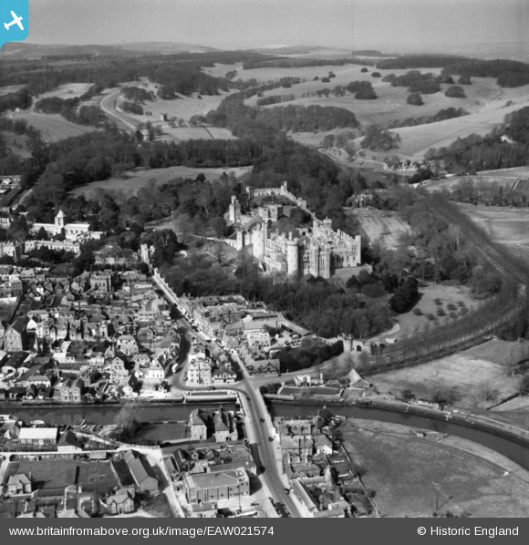
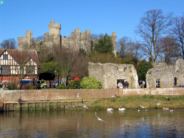
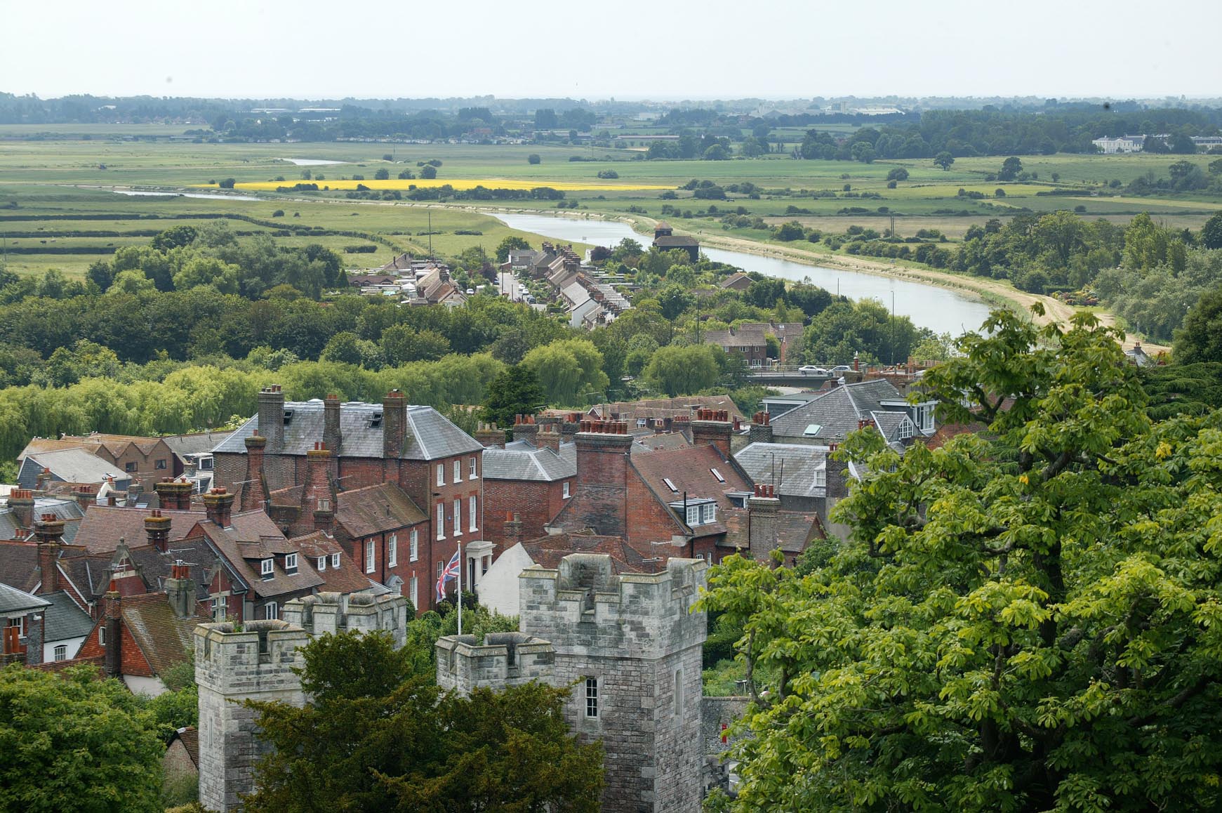
eaw021574 ENGLAND (1949). Arundel Castle overlooking the town, Arundel, from the south-east, 1949. This image has been produced from a print.
© Copyright OpenStreetMap contributors and licensed by the OpenStreetMap Foundation. 2024. Cartography is licensed as CC BY-SA.
Nearby Images (8)
EAW021574

EAW021573

EAW021572

EAW050662

EAW050664

EPW000685

EPW000686

EPW018264

Details
| Title | [EAW021574] Arundel Castle overlooking the town, Arundel, from the south-east, 1949. This image has been produced from a print. |
| Reference | EAW021574 |
| Date | 21-March-1949 |
| Link | |
| Place name | ARUNDEL |
| Parish | ARUNDEL |
| District | |
| Country | ENGLAND |
| Easting / Northing | 501955, 107057 |
| Longitude / Latitude | -0.55140759426186, 50.853473519718 |
| National Grid Reference | TQ020071 |
Pins
 Alan McFaden |
Monday 8th of September 2014 10:53:33 AM | |
Alan McFaden |
Monday 8th of September 2014 10:53:04 AM | |
Alan McFaden |
Monday 8th of September 2014 10:51:39 AM | |
Alan McFaden |
Monday 8th of September 2014 10:50:26 AM | |
Alan McFaden |
Monday 8th of September 2014 10:49:16 AM | |
Alan McFaden |
Monday 8th of September 2014 10:48:44 AM | |
Alan McFaden |
Monday 8th of September 2014 10:48:17 AM |


User Comment Contributions
 Arundel |
Alan McFaden |
Monday 8th of September 2014 10:51:01 AM |
 Arundel |
Alan McFaden |
Monday 8th of September 2014 10:50:43 AM |
 View from Arundel Castle |
Alan McFaden |
Monday 8th of September 2014 10:50:05 AM |
 View from Arundel Castle |
Alan McFaden |
Monday 8th of September 2014 10:49:41 AM |