
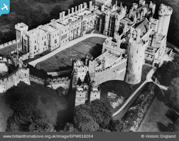
EPW018264 ENGLAND (1927). Arundel Castle, Arundel, 1927. This image has been produced from a copy-negative.
© Copyright OpenStreetMap contributors and licensed by the OpenStreetMap Foundation. 2024. Cartography is licensed as CC BY-SA.
Nearby Images (15)
EPW018264

EPW000686

EPW000726

EAW021571

EAW050661

EAW021569

EAW050663

EAW021570

EPW000685

EAW050664

EAW050662

EAW021573

EPW000684

EAW021574

EAW021576

Details
| Title | [EPW018264] Arundel Castle, Arundel, 1927. This image has been produced from a copy-negative. |
| Reference | EPW018264 |
| Date | 10-June-1927 |
| Link | |
| Place name | ARUNDEL |
| Parish | ARUNDEL |
| District | |
| Country | ENGLAND |
| Easting / Northing | 501847, 107301 |
| Longitude / Latitude | -0.5528736527874, 50.85568626613 |
| National Grid Reference | TQ018073 |
Pins
Be the first to add a comment to this image!
User Comment Contributions
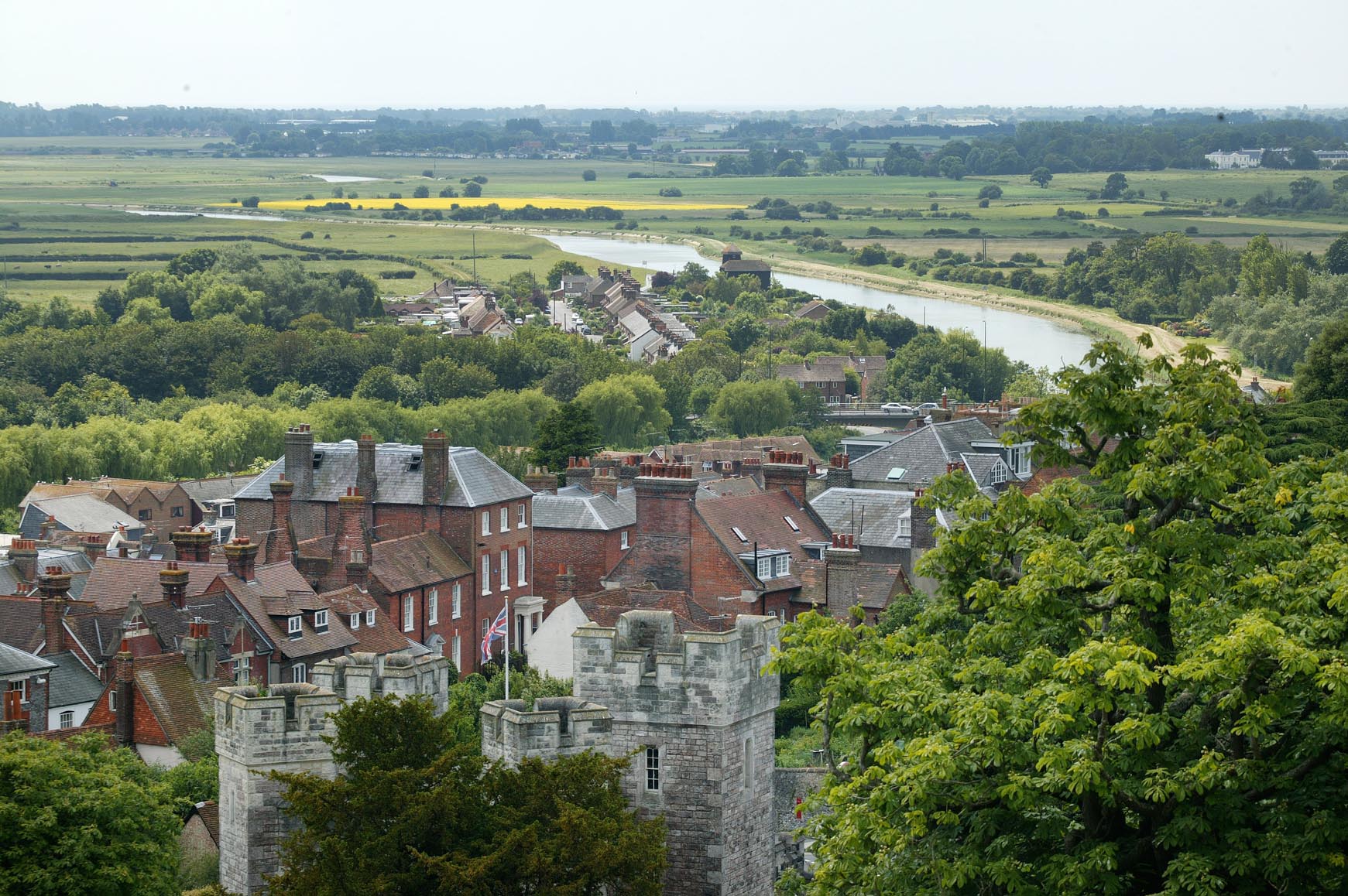 View from Arundel Castle |
 Alan McFaden |
Friday 7th of November 2014 05:50:05 PM |
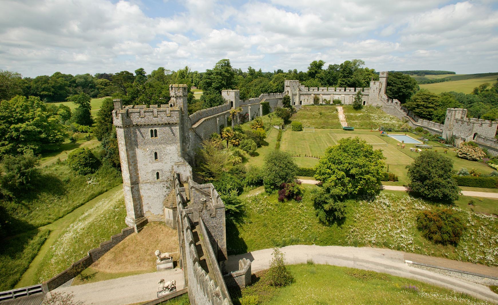
 Arundel Castle |
Alan McFaden |
Friday 7th of November 2014 05:49:41 PM |
 Arundel Castle |
Alan McFaden |
Friday 7th of November 2014 05:49:13 PM |
 Arundel Castle |
Alan McFaden |
Friday 7th of November 2014 05:48:47 PM |
 Arundel Castle |
Alan McFaden |
Friday 7th of November 2014 05:48:21 PM |