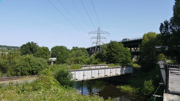
eaw020097 ENGLAND (1948). Fields between the Treeton and Brightside Railway and Bawtry Road, Tinsley, 1948. This image has been produced from a print.

© Copyright OpenStreetMap contributors and licensed by the OpenStreetMap Foundation. 2024. Cartography is licensed as CC BY-SA.
Nearby Images (7)
EAW020097

EAW020096

EAW020099

EAW020100

EAW020098

EAW020101

EAW020102

Details
| Title | [EAW020097] Fields between the Treeton and Brightside Railway and Bawtry Road, Tinsley, 1948. This image has been produced from a print. |
| Reference | EAW020097 |
| Date | 19-October-1948 |
| Link | |
| Place name | TINSLEY |
| Parish | |
| District | |
| Country | ENGLAND |
| Easting / Northing | 440067, 390227 |
| Longitude / Latitude | -1.3972231507348, 53.407076036043 |
| National Grid Reference | SK401902 |
Pins
 redmist |
Sunday 20th of January 2019 08:52:59 PM | |
 Class31 |
Monday 20th of July 2015 10:39:03 AM | |
Class31 |
Monday 20th of July 2015 10:33:59 AM | |
Class31 |
Monday 20th of July 2015 10:32:09 AM | |
RichardL |
Sunday 26th of October 2014 01:35:43 PM | |
RichardL |
Sunday 26th of October 2014 01:21:32 PM | |
RichardL |
Sunday 26th of October 2014 01:00:10 PM | |
RichardL |
Sunday 26th of October 2014 12:27:30 PM |