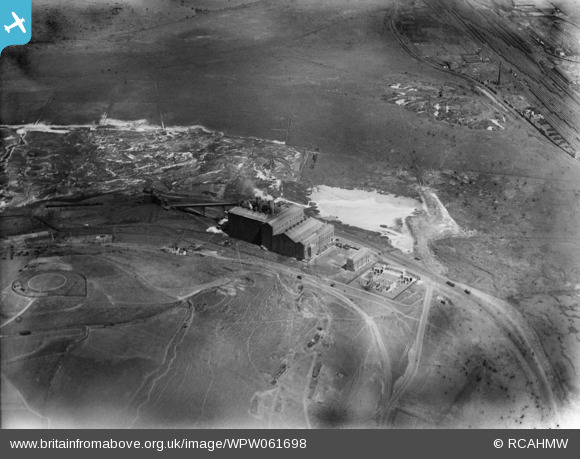
WPW061698 WALES (1939). Distant view of Tir John power station, Swansea, oblique aerial view. 5"x4" black and white glass plate negative.
© Copyright OpenStreetMap contributors and licensed by the OpenStreetMap Foundation. 2024. Cartography is licensed as CC BY-SA.
Nearby Images (13)
WPW061691
, oblique aerial view. 5\"x4\" black and white glass plate negative.")
WPW061692
, oblique aerial view. 5\"x4\" black and white glass plate negative.")
WPW061693
, oblique aerial view. 5\"x4\" black and white glass plate negative.")
WPW061694
, oblique aerial view. 5\"x4\" black and white glass plate negative.")
WPW061695
, oblique aerial view. 5\"x4\" black and white glass plate negative.")
WPW061696

WPW061697

WPW061698

WPW061699

WPW061700

WPW061701

WPW061702

WPW061703

Details
| Title | [WPW061698] Distant view of Tir John power station, Swansea, oblique aerial view. 5"x4" black and white glass plate negative. |
| Reference | WPW061698 |
| Date | 1939 |
| Link | Coflein Archive Item 6370528 |
| Place name | |
| Parish | |
| District | |
| Country | WALES |
| Easting / Northing | 268782, 193660 |
| Longitude / Latitude | -3.895893714121, 51.625967675541 |
| National Grid Reference | SS688937 |
Pins
 Nigel_Wassell |
Tuesday 28th of March 2023 05:17:11 PM | |
Nigel_Wassell |
Tuesday 28th of March 2023 05:16:40 PM | |
 Class31 |
Tuesday 30th of April 2013 10:21:17 AM | |
Class31 |
Tuesday 30th of April 2013 09:35:38 AM | |
Class31 |
Tuesday 30th of April 2013 08:48:09 AM | |
Class31 |
Tuesday 30th of April 2013 08:32:57 AM |